
No Gharuan master plan exists.
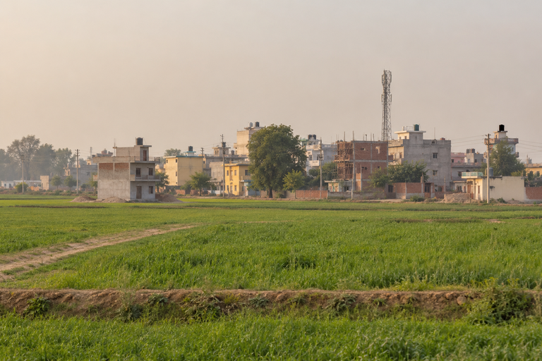
Six urban settlements in this district have notified master plans and land use plans: SAS Nagar, New Chandigarh, Banur, Zirakpur, Dera Bassi and Kharar. Gharuan is not one of them. It is a Nagar Panchayat, so it has a municipal body, but it has never had a notified plan, and the land there sits in a rural and agriculture zone where only agricultural and a few other permitted activities are allowed.
What exists, as of June 2026, is a draft. It is not a Gharuan master plan but a proposed amendment to GMADA's regional plan, and it would change what roughly 3,000 acres across Gharuan and sixteen surrounding villages is allowed to become.
What is actually proposed
The Directorate of Town and Country Planning, Punjab is set to amend GMADA's regional plan to introduce industrial and commercial activity in the Gharuan area. The draft land use plan was prepared by the Punjab Municipal Infrastructure Development Company together with the Department of Town and Country Planning, and objections and suggestions were invited from the public under Section 63(1) of the Punjab Regional and Town Planning and Development Act, 1995.
Officials told The Tribune that Gharuan was facing tremendous development pressure because of its proximity to Kharar. The stated aim is to bring it inside the same framework as the six settlements that already have notified plans.
The draft does not treat the villages alike. It sorts them into three zones, and most of what is being said about Gharuan concerns only one of the three.
The three zones, village by village
| Proposed zone | Villages |
|---|---|
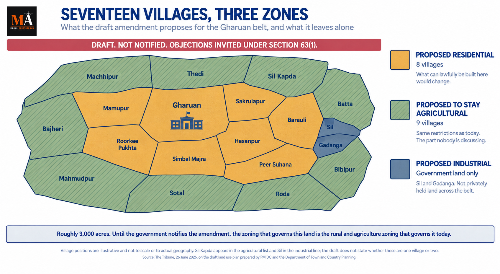
| Residential | Gharuan, Mamupur, Sakrulapur, Barauli, Hasanpur, Roorkee Pukhta, Simbal Majra, Peer Suhana |
| Agricultural | Machhipur, Thedi, Sil Kapda, Batta, Bibipur, Roda, Bajheri, Mahmudpur, Sotal |
| Industrial | Government land in Sil and Gadanga |
Eight villages proposed residential. Nine proposed agricultural. And the industrial designation, which is what the amendment is for, applies to government land in two villages rather than to the belt at large.
That last row is the one most likely to be misread. Gharuan is being opened for industrial and commercial ventures, but the industrial zone in this draft is government land in Sil and Gadanga. It is not a designation falling on privately held land across seventeen villages.
Land in one of the eight residential villages would have what can lawfully be built on it changed. Land in one of the nine agricultural villages would stay as it is, with the same restrictions that apply today. Nine of the seventeen are proposed to remain agricultural.
Two names in that table do not resolve cleanly. Sil Kapda appears in the agricultural list and Sil in the industrial line, without the draft saying whether those are one village with government land carved out or two separate villages. Gadanga carries an industrial designation while appearing in neither zone list.
Draft means draft
Nothing has been notified. A draft land use plan is a proposal by a department, and it becomes legally operative only when the government notifies it after considering what comes back. Until then, the zoning that governs any parcel here is the zoning that exists today.
The pattern in this district is well established: land in an announcement belt moves on sentiment long before anything is notified, and the people buying at that stage are buying a proposal. Our guide to the acquisition sections sets out how long those processes take once they begin, and the Gharuan proposal has not begun one. It sits a step earlier than any acquisition notification.
So anyone being told that Gharuan land is now residential or industrial is being told something that is not yet true, and anyone being told that a specific village is in the residential zone can be asked to name which of the eight it is.
What it would mean if notified
Land use decides whether a colony can be licensed, whether a change of land use can be granted, and whether a building plan can be sanctioned. A rural and agriculture designation restricts all three.
The difference between the first two rows of that table is therefore the difference between land that can eventually be developed and land that cannot, unless a later amendment changes it.
Kharar and Zirakpur grew colony by colony before their plans arrived, with arterial roads and drainage retrofitted afterwards. New Chandigarh was planned before it was built. Gharuan is being brought into the framework at a point where a Nagar Panchayat already exists and a fair amount is already there, which places it closer to the first pattern than the second.
The other amendment in the same notice
Alongside the Gharuan proposal, objections were invited on a separate amendment to the Mohali master plan, to bring around 54 acres at Manauli village from an institutional zone into an industrial and warehouse zone.
The reasoning is specific. Officials point out that Sectors 81 and 83 already carry sizeable institutional zones, with IISER and ISB established there, and that GMADA is developing IT City in Sector 82 Alpha where land has been allotted for institutions, universities and hospitals. The institutional need is already provided for elsewhere, so the Manauli land is being freed for other uses.
That says something about how plans work here. They are amended piece by piece rather than rewritten, so a plan approved years ago is not fixed, and an institutional reservation on a plan is not permanent either.
What happens next
If the amendment is notified, Gharuan joins the six settlements that already sit inside the planned framework, and eight villages move out of the rural and agriculture zone that has governed them until now.
If it is notified as drafted, nine villages do not. They stay agricultural, with the same restrictions that apply today, inside a belt where everything around them has been reclassified. Land proposed for residential use draws attention. Land proposed to remain exactly as it is draws none, which is why the nine are the part of this draft nobody is discussing and the part with the most riding on it.
Either way, the document that decides it is a draft until the government notifies it, and the zoning that governs Gharuan land this week is the zoning that governed it last year.
---
Sources
- Gharuan set to be developed as industrial, commercial zone, Gaurav Kanthwal, The Tribune, 26 June 2026, on the proposed amendment to the GMADA regional plan, the 3,000 acres across 16 surrounding villages, the residential, agricultural and industrial zone lists, Gharuan's Nagar Panchayat status and development pressure from Kharar, the preparation by PMIDC and the Department of Town and Country Planning, the invitation of objections under Section 63(1), the six settlements with notified plans, and the Manauli amendment with its reasoning
- Master Plans, Greater Mohali Area Development Authority, for the list of approved master plans and the GMADA Regional Plan
- Approved Master Plans, Punjab Urban Planning and Development Authority, for the settlements that have notified plans
Gharuan का कोई master plan मौजूद नहीं है।
इस जिले में छह urban settlements के master plans और land use plans notified हैं: SAS Nagar, New Chandigarh, Banur, Zirakpur, Dera Bassi और Kharar। Gharuan इनमें से एक नहीं है। यह एक Nagar Panchayat है, इसलिए इसका नगर निकाय तो है, लेकिन इसका कभी notified plan नहीं रहा, और वहां की ज़मीन rural और agriculture zone में आती है जहां केवल कृषि और कुछ अन्य अनुमत गतिविधियों की इजाज़त है।
जो मौजूद है, जून 2026 तक, वह एक draft है। यह Gharuan master plan नहीं बल्कि GMADA के regional plan में एक प्रस्तावित संशोधन है, और यह बदल देगा कि Gharuan और उसके आसपास के सोलह गांवों में फैले लगभग 3,000 एकड़ में क्या बनने की अनुमति होगी।
वास्तव में क्या प्रस्तावित है
Directorate of Town and Country Planning, Punjab, GMADA के regional plan में संशोधन करके Gharuan क्षेत्र में industrial और commercial गतिविधि शुरू करने वाला है। draft land use plan Punjab Municipal Infrastructure Development Company ने Department of Town and Country Planning के साथ मिलकर तैयार किया था, और Punjab Regional and Town Planning and Development Act, 1995 की Section 63(1) के तहत जनता से आपत्तियां और सुझाव आमंत्रित किए गए थे।
अधिकारियों ने The Tribune को बताया कि Kharar के निकट होने के कारण Gharuan पर विकास का भारी दबाव है। बताया गया उद्देश्य यह है कि इसे उन छह settlements के समान ढांचे के भीतर लाया जाए जिनके plans पहले से notified हैं।
draft सभी गांवों के साथ एक जैसा व्यवहार नहीं करता। यह उन्हें तीन zones में बांटता है, और Gharuan के बारे में जो कुछ भी कहा जा रहा है वह ज़्यादातर इन तीन में से केवल एक से संबंधित है।
तीन zones, गांव-दर-गांव
| प्रस्तावित zone | गांव |
|---|---|
| Residential | Gharuan, Mamupur, Sakrulapur, Barauli, Hasanpur, Roorkee Pukhta, Simbal Majra, Peer Suhana |
| Agricultural | Machhipur, Thedi, Sil Kapda, Batta, Bibipur, Roda, Bajheri, Mahmudpur, Sotal |
| Industrial | Sil और Gadanga में सरकारी ज़मीन |
आठ गांव residential प्रस्तावित। नौ agricultural प्रस्तावित। और industrial designation, जिसके लिए यह संशोधन है, दो गांवों की सरकारी ज़मीन पर लागू होता है, न कि पूरे क्षेत्र पर।
यह आखिरी पंक्ति ही सबसे ज़्यादा गलत समझे जाने की संभावना वाली है। Gharuan को industrial और commercial उपक्रमों के लिए खोला जा रहा है, लेकिन इस draft में industrial zone Sil और Gadanga की सरकारी ज़मीन है। यह सत्रह गांवों में निजी स्वामित्व वाली ज़मीन पर लागू होने वाला designation नहीं है।
आठ residential गांवों में से एक की ज़मीन पर जो कानूनी रूप से बनाया जा सकता है वह बदल जाएगा। नौ agricultural गांवों में से एक की ज़मीन जैसी है वैसी ही रहेगी, उन्हीं प्रतिबंधों के साथ जो आज लागू हैं। सत्रह में से नौ को agricultural बने रहने का प्रस्ताव है।
उस तालिका में दो नाम साफ़ तौर पर तय नहीं होते। Sil Kapda agricultural सूची में दिखता है और Sil industrial पंक्ति में, बिना यह बताए कि ये सरकारी ज़मीन अलग की गई एक ही गांव है या दो अलग गांव। Gadanga पर industrial designation है जबकि यह किसी भी zone सूची में नहीं दिखता।
Draft का मतलब draft ही है
कुछ भी notified नहीं हुआ है। draft land use plan किसी विभाग का प्रस्ताव है, और यह कानूनी रूप से तभी लागू होता है जब सरकार जो वापस आता है उस पर विचार करने के बाद इसे notify करती है। तब तक, यहां किसी भी भूखंड पर लागू zoning वही है जो आज मौजूद है।
इस जिले का तरीका सुपरिचित है: किसी announcement belt की ज़मीन भावनाओं पर तब चलने लगती है जब कुछ भी notified नहीं हुआ होता, और उस चरण में खरीदने वाले एक प्रस्ताव खरीद रहे होते हैं। हमारी acquisition sections की गाइड बताती है कि एक बार शुरू होने के बाद इन प्रक्रियाओं में कितना समय लगता है, और Gharuan प्रस्ताव ने कोई प्रक्रिया शुरू नहीं की है। यह किसी भी acquisition notification से एक कदम पहले की स्थिति में है।
तो जिस किसी को यह बताया जा रहा है कि Gharuan की ज़मीन अब residential या industrial है, उसे ऐसा कुछ बताया जा रहा है जो अभी सच नहीं है, और जिस किसी से यह कहा जा रहा है कि कोई विशेष गांव residential zone में है, उससे पूछा जा सकता है कि वह आठ में से कौन-सा है।
अगर notified हो जाए तो क्या मतलब होगा
Land use तय करता है कि किसी colony को लाइसेंस मिल सकता है या नहीं, change of land use दिया जा सकता है या नहीं, और building plan मंजूर हो सकता है या नहीं। rural और agriculture designation तीनों को सीमित करता है।
इसलिए उस तालिका की पहली दो पंक्तियों के बीच का अंतर उस ज़मीन के बीच का अंतर है जिसे आगे चलकर विकसित किया जा सकता है और उस ज़मीन के बीच जिसे नहीं, जब तक कोई बाद का संशोधन इसे न बदले।
Kharar और Zirakpur अपने plans आने से पहले colony-दर-colony बढ़े, arterial roads और drainage बाद में जोड़े गए। New Chandigarh बनने से पहले plan किया गया था। Gharuan को ढांचे में ऐसे समय लाया जा रहा है जब एक Nagar Panchayat पहले से मौजूद है और काफी कुछ पहले से है, जो इसे पहले तरीके के ज़्यादा करीब रखता है, दूसरे के नहीं।
उसी notice में दूसरा संशोधन
Gharuan प्रस्ताव के साथ-साथ, Mohali master plan में एक अलग संशोधन पर भी आपत्तियां आमंत्रित की गईं, जिससे Manauli गांव में लगभग 54 एकड़ को institutional zone से industrial और warehouse zone में लाया जाए।
तर्क विशिष्ट है। अधिकारियों का कहना है कि Sector 81 और 83 में पहले से बड़े institutional zones हैं, जहां IISER और ISB स्थापित हैं, और GMADA Sector 82 Alpha में IT City विकसित कर रहा है जहां संस्थानों, विश्वविद्यालयों और अस्पतालों के लिए ज़मीन आवंटित की गई है। institutional ज़रूरत कहीं और पहले से पूरी है, इसलिए Manauli की ज़मीन अन्य उपयोगों के लिए खाली की जा रही है।
यह बताता है कि यहां plans कैसे काम करते हैं। इन्हें फिर से लिखने के बजाय टुकड़े-टुकड़े करके संशोधित किया जाता है, इसलिए वर्षों पहले मंजूर किया गया plan स्थिर नहीं होता, और किसी plan पर institutional reservation भी स्थायी नहीं होता।
आगे क्या होगा
अगर संशोधन notified हो जाता है, तो Gharuan उन छह settlements में शामिल हो जाता है जो पहले से नियोजित ढांचे के भीतर हैं, और आठ गांव उस rural और agriculture zone से बाहर आ जाते हैं जिसने अब तक उन्हें नियंत्रित किया है।
अगर यह draft के अनुसार notified होता है, तो नौ गांव बाहर नहीं आते। वे agricultural बने रहते हैं, उन्हीं प्रतिबंधों के साथ जो आज लागू हैं, ऐसे क्षेत्र के भीतर जहां उनके आसपास का सब कुछ पुनर्वर्गीकृत कर दिया गया है। residential उपयोग के लिए प्रस्तावित ज़मीन ध्यान खींचती है। जिस ज़मीन को बिल्कुल वैसा ही बने रहने का प्रस्ताव है वह कोई ध्यान नहीं खींचती, इसीलिए ये नौ इस draft का वह हिस्सा हैं जिस पर कोई चर्चा नहीं कर रहा और जिस पर सबसे ज़्यादा दांव लगा है।
किसी भी तरह, जो दस्तावेज़ इसे तय करता है वह तब तक एक draft है जब तक सरकार इसे notify नहीं करती, और इस हफ्ते Gharuan की ज़मीन पर जो zoning लागू है वही पिछले साल भी लागू थी।
---
Sources
- Gharuan set to be developed as industrial, commercial zone, Gaurav Kanthwal, The Tribune, 26 June 2026, on the proposed amendment to the GMADA regional plan, the 3,000 acres across 16 surrounding villages, the residential, agricultural and industrial zone lists, Gharuan's Nagar Panchayat status and development pressure from Kharar, the preparation by PMIDC and the Department of Town and Country Planning, the invitation of objections under Section 63(1), the six settlements with notified plans, and the Manauli amendment with its reasoning
- Master Plans, Greater Mohali Area Development Authority, for the list of approved master plans and the GMADA Regional Plan
- Approved Master Plans, Punjab Urban Planning and Development Authority, for the settlements that have notified plans
ਗੁਰੂਆਂ ਦਾ ਕੋਈ ਮਾਸਟਰ ਪਲਾਨ ਨਹੀਂ ਹੈ।
ਇਸ ਜ਼ਿਲ੍ਹੇ ਦੀਆਂ ਛੇ ਸ਼ਹਿਰੀ ਬਸਤੀਆਂ ਦੇ ਮਾਸਟਰ ਪਲਾਨ ਅਤੇ ਜ਼ਮੀਨੀ ਵਰਤੋਂ ਦੇ ਪਲਾਨ ਨੋਟੀਫਾਈ ਹੋ ਚੁੱਕੇ ਹਨ: SAS Nagar, New Chandigarh, Banur, Zirakpur, Dera Bassi ਅਤੇ Kharar। ਗੁਰੂਆਂ ਇਨ੍ਹਾਂ ਵਿੱਚੋਂ ਇੱਕ ਨਹੀਂ ਹੈ। ਇਹ ਇੱਕ ਨਗਰ ਪੰਚਾਇਣ ਹੈ, ਇਸ ਲਈ ਇਸਦੀ ਇੱਕ ਨਗਰਪਾਲਿਕਾ ਹੈ, ਪਰ ਇਸਦਾ ਕਦੇ ਵੀ ਕੋਈ ਨੋਟੀਫਾਈ ਪਲਾਨ ਨਹੀਂ ਰਿਹਾ, ਅਤੇ ਉੱਥੇ ਦੀ ਜ਼ਮੀਨ ਪੇਂਡੂ ਅਤੇ ਖੇਤੀਬਾੜੀ ਜ਼ੋਨ ਵਿੱਚ ਪੈਂਦੀ ਹੈ ਜਿੱਥੇ ਸਿਰਫ਼ ਖੇਤੀਬਾੜੀ ਅਤੇ ਕੁਝ ਹੋਰ ਪ੍ਰਵਾਨਿਤ ਗਤੀਵਿਧੀਆਂ ਦੀ ਆਗਿਆ ਹੈ।
ਜੂਨ 2026 ਤੱਕ, ਜੋ ਮੌਜੂਦ ਹੈ, ਉਹ ਇੱਕ ਡਰਾਫਟ ਹੈ। ਇਹ ਗੁਰੂਆਂ ਦਾ ਮਾਸਟਰ ਪਲਾਨ ਨਹੀਂ ਸਗੋਂ GMADA ਦੇ ਖੇਤਰੀ ਪਲਾਨ ਵਿੱਚ ਇੱਕ ਪ੍ਰਸਤਾਵਿਤ ਸੋਧ ਹੈ, ਅਤੇ ਇਹ ਬਦਲ ਦੇਵੇਗਾ ਕਿ ਗੁਰੂਆਂ ਅਤੇ ਆਲੇ-ਦੁਆਲੇ ਦੇ ਸੋਲਾਂ ਪਿੰਡਾਂ ਵਿੱਚ ਲਗਭਗ 3,000 ਏਕੜ ਜ਼ਮੀਨ ਨੂੰ ਕੀ ਬਣਨ ਦੀ ਆਗਿਆ ਹੋਵੇਗੀ।
ਅਸਲ ਵਿੱਚ ਕੀ ਪ੍ਰਸਤਾਵਿਤ ਹੈ
Directorate of Town and Country Planning, Punjab ਗੁਰੂਆਂ ਖੇਤਰ ਵਿੱਚ ਉਦਯੋਗਿਕ ਅਤੇ ਵਪਾਰਕ ਗਤੀਵਿਧੀ ਸ਼ੁਰੂ ਕਰਨ ਲਈ GMADA ਦੇ ਖੇਤਰੀ ਪਲਾਨ ਵਿੱਚ ਸੋਧ ਕਰਨ ਵਾਲੀ ਹੈ। ਡਰਾਫਟ ਜ਼ਮੀਨੀ ਵਰਤੋਂ ਪਲਾਨ Punjab Municipal Infrastructure Development Company ਨੇ Department of Town and Country Planning ਦੇ ਨਾਲ ਮਿਲ ਕੇ ਤਿਆਰ ਕੀਤਾ ਸੀ, ਅਤੇ Punjab Regional and Town Planning and Development Act, 1995 ਦੀ ਧਾਰਾ 63(1) ਅਧੀਨ ਜਨਤਾ ਤੋਂ ਇਤਰਾਜ਼ ਅਤੇ ਸੁਝਾਅ ਮੰਗੇ ਗਏ ਸਨ।
ਅਧਿਕਾਰੀਆਂ ਨੇ The Tribune ਨੂੰ ਦੱਸਿਆ ਕਿ ਗੁਰੂਆਂ ਨੂੰ Kharar ਨਾਲ ਨੇੜਤਾ ਦੇ ਕਾਰਨ ਭਾਰੀ ਵਿਕਾਸ ਦਬਾਅ ਦਾ ਸਾਹਮਣਾ ਕਰਨਾ ਪੈ ਰਿਹਾ ਸੀ। ਦੱਸਿਆ ਗਿਆ ਟੀਚਾ ਇਸਨੂੰ ਉਸੇ ਢਾਂਚੇ ਦੇ ਅੰਦਰ ਲਿਆਉਣਾ ਹੈ ਜਿਸ ਵਿੱਚ ਛੇ ਬਸਤੀਆਂ ਹਨ ਜਿਨ੍ਹਾਂ ਦੇ ਪਹਿਲਾਂ ਹੀ ਨੋਟੀਫਾਈ ਪਲਾਨ ਹਨ।
ਡਰਾਫਟ ਪਿੰਡਾਂ ਨਾਲ ਇੱਕੋ ਜਿਹਾ ਵਿਵਹਾਰ ਨਹੀਂ ਕਰਦਾ। ਇਹ ਉਨ੍ਹਾਂ ਨੂੰ ਤਿੰਨ ਜ਼ੋਨਾਂ ਵਿੱਚ ਵੰਡਦਾ ਹੈ, ਅਤੇ ਗੁਰੂਆਂ ਬਾਰੇ ਜੋ ਕੁਝ ਵੀ ਕਿਹਾ ਜਾ ਰਿਹਾ ਹੈ, ਉਸਦਾ ਜ਼ਿਆਦਾਤਰ ਹਿੱਸਾ ਤਿੰਨਾਂ ਵਿੱਚੋਂ ਸਿਰਫ਼ ਇੱਕ ਨਾਲ ਸੰਬੰਧਿਤ ਹੈ।
ਤਿੰਨ ਜ਼ੋਨ, ਪਿੰਡ ਪਿੰਡ
| ਪ੍ਰਸਤਾਵਿਤ ਜ਼ੋਨ | ਪਿੰਡ |
|---|---|
| ਰਿਹਾਇਸ਼ੀ | Gharuan, Mamupur, Sakrulapur, Barauli, Hasanpur, Roorkee Pukhta, Simbal Majra, Peer Suhana |
| ਖੇਤੀਬਾੜੀ | Machhipur, Thedi, Sil Kapda, Batta, Bibipur, Roda, Bajheri, Mahmudpur, Sotal |
| ਉਦਯੋਗਿਕ | Sil ਅਤੇ Gadanga ਵਿੱਚ ਸਰਕਾਰੀ ਜ਼ਮੀਨ |
ਅੱਠ ਪਿੰਡ ਰਿਹਾਇਸ਼ੀ ਪ੍ਰਸਤਾਵਿਤ। ਨੌਂ ਖੇਤੀਬਾੜੀ ਪ੍ਰਸਤਾਵਿਤ। ਅਤੇ ਉਦਯੋਗਿਕ ਨਾਮਜ਼ਦਗੀ, ਜਿਸ ਲਈ ਇਹ ਸੋਧ ਹੈ, ਦੋ ਪਿੰਡਾਂ ਵਿੱਚ ਸਰਕਾਰੀ ਜ਼ਮੀਨ 'ਤੇ ਲਾਗੂ ਹੁੰਦੀ ਹੈ ਨਾ ਕਿ ਪੂਰੇ ਪੱਟੀ 'ਤੇ।
ਇਹ ਆਖਰੀ ਕਤਾਰ ਹੀ ਸਭ ਤੋਂ ਵੱਧ ਗਲਤ ਸਮਝੇ ਜਾਣ ਦੀ ਸੰਭਾਵਨਾ ਵਾਲੀ ਹੈ। ਗੁਰੂਆਂ ਨੂੰ ਉਦਯੋਗਿਕ ਅਤੇ ਵਪਾਰਕ ਉੱਦਮਾਂ ਲਈ ਖੋਲ੍ਹਿਆ ਜਾ ਰਿਹਾ ਹੈ, ਪਰ ਇਸ ਡਰਾਫਟ ਵਿੱਚ ਉਦਯੋਗਿਕ ਜ਼ੋਨ Sil ਅਤੇ Gadanga ਵਿੱਚ ਸਰਕਾਰੀ ਜ਼ਮੀਨ ਹੈ। ਇਹ ਸਤਾਰਾਂ ਪਿੰਡਾਂ ਵਿੱਚ ਨਿੱਜੀ ਮਲਕੀਅਤ ਵਾਲੀ ਜ਼ਮੀਨ 'ਤੇ ਪੈਣ ਵਾਲੀ ਨਾਮਜ਼ਦਗੀ ਨਹੀਂ ਹੈ।
ਅੱਠ ਰਿਹਾਇਸ਼ੀ ਪਿੰਡਾਂ ਵਿੱਚੋਂ ਇੱਕ ਦੀ ਜ਼ਮੀਨ 'ਤੇ ਕਾਨੂੰਨੀ ਤੌਰ 'ਤੇ ਕੀ ਬਣਾਇਆ ਜਾ ਸਕਦਾ ਹੈ, ਉਹ ਬਦਲ ਜਾਵੇਗਾ। ਨੌਂ ਖੇਤੀਬਾੜੀ ਪਿੰਡਾਂ ਵਿੱਚੋਂ ਇੱਕ ਦੀ ਜ਼ਮੀਨ ਜਿਵੇਂ ਹੈ ਤਿਵੇਂ ਹੀ ਰਹੇਗੀ, ਉਹੀ ਪਾਬੰਦੀਆਂ ਲਾਗੂ ਰਹਿਣਗੀਆਂ ਜੋ ਅੱਜ ਹਨ। ਸਤਾਰਾਂ ਵਿੱਚੋਂ ਨੌਂ ਖੇਤੀਬਾੜੀ ਰਹਿਣ ਦਾ ਪ੍ਰਸਤਾਵ ਹੈ।
ਉਸ ਟੇਬਲ ਵਿੱਚ ਦੋ ਨਾਮ ਸਾਫ਼-ਸਾਫ਼ ਹੱਲ ਨਹੀਂ ਹੁੰਦੇ। Sil Kapda ਖੇਤੀਬਾੜੀ ਸੂਚੀ ਵਿੱਚ ਆਉਂਦਾ ਹੈ ਅਤੇ Sil ਉਦਯੋਗਿਕ ਕਤਾਰ ਵਿੱਚ, ਬਿਨਾਂ ਇਹ ਦੱਸੇ ਕਿ ਇਹ ਸਰਕਾਰੀ ਜ਼ਮੀਨ ਕੱਢੇ ਗਏ ਇੱਕ ਪਿੰਡ ਹਨ ਜਾਂ ਦੋ ਵੱਖਰੇ ਪਿੰਡ। Gadanga ਉਦਯੋਗਿਕ ਨਾਮਜ਼ਦਗੀ ਰੱਖਦਾ ਹੈ ਜਦੋਂ ਕਿ ਇਹ ਕਿਸੇ ਵੀ ਜ਼ੋਨ ਸੂਚੀ ਵਿੱਚ ਨਹੀਂ ਆਉਂਦਾ।
ਡਰਾਫਟ ਦਾ ਮਤਲਬ ਡਰਾਫਟ
ਕੁਝ ਵੀ ਨੋਟੀਫਾਈ ਨਹੀਂ ਹੋਇਆ। ਡਰਾਫਟ ਜ਼ਮੀਨੀ ਵਰਤੋਂ ਪਲਾਨ ਇੱਕ ਵਿਭਾਗ ਦਾ ਪ੍ਰਸਤਾਵ ਹੈ, ਅਤੇ ਇਹ ਕਾਨੂੰਨੀ ਤੌਰ 'ਤੇ ਲਾਗੂ ਹੋਵੇਗਾ ਜਦੋਂ ਸਰਕਾਰ ਜੋ ਵਾਪਸ ਆਵੇ ਉਸ 'ਤੇ ਵਿਚਾਰ ਕਰਨ ਤੋਂ ਬਾਅਦ ਇਸਨੂੰ ਨੋਟੀਫਾਈ ਕਰੇਗੀ। ਉਦੋਂ ਤੱਕ, ਇੱਥੇ ਕਿਸੇ ਵੀ ਪਲਾਟ ਨੂੰ ਨਿਯੰਤਰਿਤ ਕਰਨ ਵਾਲੀ ਜ਼ੋਨਿੰਗ ਉਹੀ ਜ਼ੋਨਿੰਗ ਹੈ ਜੋ ਅੱਜ ਮੌਜੂਦ ਹੈ।
ਇਸ ਜ਼ਿਲ੍ਹੇ ਵਿੱਚ ਪੈਟਰਨ ਚੰਗੀ ਤਰ੍ਹਾਂ ਸਥਾਪਿਤ ਹੈ: ਐਲਾਨ ਵਾਲੀ ਪੱਟੀ ਵਿੱਚ ਜ਼ਮੀਨ ਕੁਝ ਵੀ ਨੋਟੀਫਾਈ ਹੋਣ ਤੋਂ ਬਹੁਤ ਪਹਿਲਾਂ ਭਾਵਨਾ 'ਤੇ ਹਿਲਦੀ ਹੈ, ਅਤੇ ਉਸ ਪੜਾਅ 'ਤੇ ਖਰੀਦਣ ਵਾਲੇ ਲੋਕ ਇੱਕ ਪ੍ਰਸਤਾਵ ਖਰੀਦ ਰਹੇ ਹੁੰਦੇ ਹਨ। ਸਾਡੀ ਐਕਵੀਜ਼ੀਸ਼ਨ ਸੈਕਸ਼ਨਾਂ ਦੀ ਗਾਈਡ ਦੱਸਦੀ ਹੈ ਕਿ ਇੱਕ ਵਾਰ ਸ਼ੁਰੂ ਹੋਣ ਤੋਂ ਬਾਅਦ ਉਹ ਪ੍ਰਕਿਰਿਆਵਾਂ ਕਿੰਨੀ ਸਮਾਂ ਲੈਂਦੀਆਂ ਹਨ, ਅਤੇ ਗੁਰੂਆਂ ਪ੍ਰਸਤਾਵ ਨੇ ਕੋਈ ਵੀ ਸ਼ੁਰੂ ਨਹੀਂ ਕੀਤੀ। ਇਹ ਕਿਸੇ ਵੀ ਐਕਵੀਜ਼ੀਸ਼ਨ ਨੋਟਿਸ ਤੋਂ ਇੱਕ ਕਦਮ ਪਹਿਲਾਂ ਬੈਠਾ ਹੈ।
ਇਸ ਲਈ ਜਿਸਨੂੰ ਵੀ ਇਹ ਦੱਸਿਆ ਜਾ ਰਿਹਾ ਹੈ ਕਿ ਗੁਰੂਆਂ ਦੀ ਜ਼ਮੀਨ ਹੁਣ ਰਿਹਾਇਸ਼ੀ ਜਾਂ ਉਦਯੋਗਿਕ ਹੈ, ਉਸਨੂੰ ਕੁਝ ਅਜਿਹਾ ਦੱਸਿਆ ਜਾ ਰਿਹਾ ਹੈ ਜੋ ਅਜੇ ਸੱਚ ਨਹੀਂ ਹੈ, ਅਤੇ ਜਿਸਨੂੰ ਵੀ ਇਹ ਦੱਸਿਆ ਜਾ ਰਿਹਾ ਹੈ ਕਿ ਕੋਈ ਖਾਸ ਪਿੰਡ ਰਿਹਾਇਸ਼ੀ ਜ਼ੋਨ ਵਿੱਚ ਹੈ, ਉਸਨੂੰ ਪੁੱਛਿਆ ਜਾ ਸਕਦਾ ਹੈ ਕਿ ਉਹ ਅੱਠਾਂ ਵਿੱਚੋਂ ਕਿਹੜਾ ਹੈ।
ਜੇ ਨੋਟੀਫਾਈ ਹੋਵੇ ਤਾਂ ਕੀ ਮਤਲਬ ਹੋਵੇਗਾ
ਜ਼ਮੀਨੀ ਵਰਤੋਂ ਫੈਸਲਾ ਕਰਦੀ ਹੈ ਕਿ ਕੋਈ ਕਾਲੋਨੀ ਲਾਇਸੰਸਸ਼ੁਦਾ ਹੋ ਸਕਦੀ ਹੈ, ਜ਼ਮੀਨੀ ਵਰਤੋਂ ਦੀ ਤਬਦੀਲੀ ਦਿੱਤੀ ਜਾ ਸਕਦੀ ਹੈ, ਅਤੇ ਇਮਾਰਤ ਪਲਾਨ ਮਨਜ਼ੂਰ ਹੋ ਸਕਦਾ ਹੈ। ਪੇਂਡੂ ਅਤੇ ਖੇਤੀਬਾੜੀ ਨਾਮਜ਼ਦਗੀ ਤਿੰਨਾਂ ਨੂੰ ਸੀਮਤ ਕਰਦੀ ਹੈ।
ਉਸ ਟੇਬਲ ਦੀਆਂ ਪਹਿਲੀਆਂ ਦੋ ਕਤਾਰਾਂ ਵਿਚਕਾਰ ਅੰਤਰ ਇਸ ਲਈ ਉਸ ਜ਼ਮੀਨ ਵਿਚਕਾਰ ਅੰਤਰ ਹੈ ਜੋ ਆਖਰਕਾਰ ਵਿਕਸਿਤ ਹੋ ਸਕਦੀ ਹੈ ਅਤੇ ਉਸ ਜ਼ਮੀਨ ਵਿਚਕਾਰ ਜੋ ਨਹੀਂ ਹੋ ਸਕਦੀ, ਜਦੋਂ ਤੱਕ ਕੋਈ ਬਾਅਦ ਦੀ ਸੋਧ ਇਸਨੂੰ ਨਾ ਬਦਲੇ।
Kharar ਅਤੇ Zirakpur ਆਪਣੇ ਪਲਾਨ ਆਉਣ ਤੋਂ ਪਹਿਲਾਂ ਕਾਲੋਨੀ-ਕਾਲੋਨੀ ਵਧੇ, ਮੁੱਖ ਸੜਕਾਂ ਅਤੇ ਡਰੇਨੇਜ ਬਾਅਦ ਵਿੱਚ ਜੋੜੇ ਗਏ। New Chandigarh ਬਣਨ ਤੋਂ ਪਹਿਲਾਂ ਪਲਾਨ ਕੀਤਾ ਗਿਆ ਸੀ। ਗੁਰੂਆਂ ਨੂੰ ਢਾਂਚੇ ਵਿੱਚ ਉਸ ਮੋੜ 'ਤੇ ਲਿਆਂਦਾ ਜਾ ਰਿਹਾ ਹੈ ਜਿੱਥੇ ਇੱਕ ਨਗਰ ਪੰਚਾਇਣ ਪਹਿਲਾਂ ਹੀ ਮੌਜੂਦ ਹੈ ਅਤੇ ਕਾਫ਼ੀ ਕੁਝ ਪਹਿਲਾਂ ਹੀ ਉੱਥੇ ਹੈ, ਜੋ ਇਸਨੂੰ ਦੂਜੇ ਪੈਟਰਨ ਨਾਲੋਂ ਪਹਿਲੇ ਪੈਟਰਨ ਦੇ ਵੱਧ ਨੇੜੇ ਰੱਖਦਾ ਹੈ।
ਉਸੇ ਨੋਟਿਸ ਵਿੱਚ ਦੂਜੀ ਸੋਧ
ਗੁਰੂਆਂ ਪ੍ਰਸਤਾਵ ਦੇ ਨਾਲ-ਨਾਲ, ਮੋਹਾਲੀ ਮਾਸਟਰ ਪਲਾਨ ਵਿੱਚ ਇੱਕ ਵੱਖਰੀ ਸੋਧ 'ਤੇ ਇਤਰਾਜ਼ ਮੰਗੇ ਗਏ ਸਨ, ਤਾਂ ਜੋ Manauli ਪਿੰਡ ਵਿੱਚ ਲਗਭਗ 54 ਏਕੜ ਨੂੰ ਸੰਸਥਾਗਤ ਜ਼ੋਨ ਤੋਂ ਉਦਯੋਗਿਕ ਅਤੇ ਗੋਦਾਮ ਜ਼ੋਨ ਵਿੱਚ ਲਿਆਂਦਾ ਜਾ ਸਕੇ।
ਕਾਰਨ ਖਾਸ ਹੈ। ਅਧਿਕਾਰੀ ਦੱਸਦੇ ਹਨ ਕਿ ਸੈਕਟਰ 81 ਅਤੇ 83 ਵਿੱਚ ਪਹਿਲਾਂ ਹੀ ਵੱਡੇ ਸੰਸਥਾਗਤ ਜ਼ੋਨ ਹਨ, ਜਿੱਥੇ IISER ਅਤੇ ISB ਸਥਾਪਿਤ ਹਨ, ਅਤੇ ਇਹ ਕਿ GMADA ਸੈਕਟਰ 82 Alpha ਵਿੱਚ IT City ਵਿਕਸਿਤ ਕਰ ਰਹੀ ਹੈ ਜਿੱਥੇ ਸੰਸਥਾਵਾਂ, ਯੂਨੀਵਰਸਿਟੀਆਂ ਅਤੇ ਹਸਪਤਾਲਾਂ ਲਈ ਜ਼ਮੀਨ ਅਲਾਟ ਕੀਤੀ ਗਈ ਹੈ। ਸੰਸਥਾਗਤ ਲੋੜ ਪਹਿਲਾਂ ਹੀ ਕਿਤੇ ਹੋਰ ਪੂਰੀ ਕੀਤੀ ਜਾ ਚੁੱਕੀ ਹੈ, ਇਸ ਲਈ Manauli ਦੀ ਜ਼ਮੀਨ ਹੋਰ ਵਰਤੋਂ ਲਈ ਖਾਲੀ ਕੀਤੀ ਜਾ ਰਹੀ ਹੈ।
ਇਹ ਇਸ ਬਾਰੇ ਕੁਝ ਦੱਸਦਾ ਹੈ ਕਿ ਇੱਥੇ ਪਲਾਨ ਕਿਵੇਂ ਕੰਮ ਕਰਦੇ ਹਨ। ਇਹਨਾਂ ਨੂੰ ਦੁਬਾਰਾ ਲਿਖਣ ਦੀ ਬਜਾਏ ਟੁਕੜੇ-ਟੁਕੜੇ ਕਰਕੇ ਸੋਧਿਆ ਜਾਂਦਾ ਹੈ, ਇਸ ਲਈ ਸਾਲਾਂ ਪਹਿਲਾਂ ਮਨਜ਼ੂਰ ਹੋਇਆ ਪਲਾਨ ਸਥਿਰ ਨਹੀਂ ਹੁੰਦਾ, ਅਤੇ ਇੱਕ ਪਲਾਨ 'ਤੇ ਸੰਸਥਾਗਤ ਅਰਾਖਣ ਵੀ ਸਥਾਈ ਨਹੀਂ ਹੁੰਦਾ।
ਅੱਗੇ ਕੀ ਹੁੰਦਾ ਹੈ
ਜੇ ਸੋਧ ਨੋਟੀਫਾਈ ਹੋ ਜਾਵੇ, ਤਾਂ ਗੁਰੂਆਂ ਉਨ੍ਹਾਂ ਛੇ ਬਸਤੀਆਂ ਵਿੱਚ ਸ਼ਾਮਲ ਹੋ ਜਾਂਦਾ ਹੈ ਜੋ ਪਹਿਲਾਂ ਹੀ ਪਲਾਨ ਕੀਤੇ ਢਾਂਚੇ ਦੇ ਅੰਦਰ ਹਨ, ਅਤੇ ਅੱਠ ਪਿੰਡ ਉਸ ਪੇਂਡੂ ਅਤੇ ਖੇਤੀਬਾੜੀ ਜ਼ੋਨ ਵਿੱਚੋਂ ਬਾਹਰ ਨਿਕਲ ਜਾਂਦੇ ਹਨ ਜੋ ਹੁਣ ਤੱਕ ਉਨ੍ਹਾਂ ਨੂੰ ਨਿਯੰਤਰਿਤ ਕਰ ਰਿਹਾ ਸੀ।
ਜੇ ਇਹ ਡਰਾਫਟ ਅਨੁਸਾਰ ਨੋਟੀਫਾਈ ਹੋ ਜਾਵੇ, ਤਾਂ ਨੌਂ ਪਿੰਡ ਨਹੀਂ ਹੁੰਦੇ। ਉਹ ਖੇਤੀਬਾੜੀ ਹੀ ਰਹਿੰਦੇ ਹਨ, ਉਹੀ ਪਾਬੰਦੀਆਂ ਲਾਗੂ ਰਹਿੰਦੀਆਂ ਹਨ ਜੋ ਅੱਜ ਹਨ, ਇੱਕ ਅਜਿਹੀ ਪੱਟੀ ਦੇ ਅੰਦਰ ਜਿੱਥੇ ਉਨ੍ਹਾਂ ਦੇ ਆਲੇ-ਦੁਆਲੇ ਦਾ ਸਭ ਕੁਝ ਮੁੜ ਵਰਗੀਕ੍ਰਿਤ ਕੀਤਾ ਗਿਆ ਹੈ। ਰਿਹਾਇਸ਼ੀ ਵਰਤੋਂ ਲਈ ਪ੍ਰਸਤਾਵਿਤ ਜ਼ਮੀਨ ਧਿਆਨ ਖਿੱਚਦੀ ਹੈ। ਜਿਸ ਜ਼ਮੀਨ ਨੂੰ ਬਿਲਕੁਲ ਜਿਵੇਂ ਹੈ ਤਿਵੇਂ ਹੀ ਰਹਿਣ ਦਾ ਪ੍ਰਸਤਾਵ ਹੈ, ਉਹ ਕੋਈ ਧਿਆਨ ਨਹੀਂ ਖਿੱਚਦੀ, ਇਸ ਲਈ ਹੀ ਨੌਂ ਇਸ ਡਰਾਫਟ ਦਾ ਉਹ ਹਿੱਸਾ ਹਨ ਜਿਸ ਬਾਰੇ ਕੋਈ ਗੱਲ ਨਹੀਂ ਕਰ ਰਿਹਾ ਅਤੇ ਜਿਸ 'ਤੇ ਸਭ ਤੋਂ ਵੱਧ ਨਿਰਭਰ ਕਰਦਾ ਹੈ।
ਕਿਸੇ ਵੀ ਹਾਲਤ ਵਿੱਚ, ਇਸਨੂੰ ਤੈਅ ਕਰਨ ਵਾਲਾ ਦਸਤਾਵੇਜ਼ ਇੱਕ ਡਰਾਫਟ ਹੈ ਜਦੋਂ ਤੱਕ ਸਰਕਾਰ ਇਸਨੂੰ ਨੋਟੀਫਾਈ ਨਹੀਂ ਕਰਦੀ, ਅਤੇ ਇਸ ਹਫ਼ਤੇ ਗੁਰੂਆਂ ਦੀ ਜ਼ਮੀਨ ਨੂੰ ਨਿਯੰਤਰਿਤ ਕਰਨ ਵਾਲੀ ਜ਼ੋਨਿੰਗ ਉਹੀ ਹੈ ਜੋ ਪਿਛਲੇ ਸਾਲ ਨਿਯੰਤਰਿਤ ਕਰਦੀ ਸੀ।
---
ਸਰੋਤ
- Gharuan set to be developed as industrial, commercial zone, Gaurav Kanthwal, The Tribune, 26 ਜੂਨ 2026, GMADA ਖੇਤਰੀ ਪਲਾਨ ਵਿੱਚ ਪ੍ਰਸਤਾਵਿਤ ਸੋਧ, 16 ਆਲੇ-ਦੁਆਲੇ ਦੇ ਪਿੰਡਾਂ ਵਿੱਚ 3,000 ਏਕੜ, ਰਿਹਾਇਸ਼ੀ, ਖੇਤੀਬਾੜੀ ਅਤੇ ਉਦਯੋਗਿਕ ਜ਼ੋਨ ਸੂਚੀਆਂ, ਗੁਰੂਆਂ ਦੀ ਨਗਰ ਪੰਚਾਇਣ ਸਥਿਤੀ ਅਤੇ Kharar ਤੋਂ ਵਿਕਾਸ ਦਬਾਅ, PMIDC ਅਤੇ Department of Town and Country Planning ਵੱਲੋਂ ਤਿਆਰੀ, ਧਾਰਾ 63(1) ਅਧੀਨ ਇਤਰਾਜ਼ਾਂ ਦਾ ਸੱਦਾ, ਨੋਟੀਫਾਈ ਪਲਾਨਾਂ ਵਾਲੀਆਂ ਛੇ ਬਸਤੀਆਂ, ਅਤੇ Manauli ਸੋਧ ਅਤੇ ਇਸਦੇ ਕਾਰਨ ਬਾਰੇ
- Master Plans, Greater Mohali Area Development Authority, ਮਨਜ਼ੂਰਸ਼ੁਦਾ ਮਾਸਟਰ ਪਲਾਨਾਂ ਅਤੇ GMADA ਖੇਤਰੀ ਪਲਾਨ ਦੀ ਸੂਚੀ ਲਈ
- Approved Master Plans, Punjab Urban Planning and Development Authority, ਉਨ੍ਹਾਂ ਬਸਤੀਆਂ ਲਈ ਜਿਨ੍ਹਾਂ ਦੇ ਨੋਟੀਫਾਈ ਪਲਾਨ ਹਨ