
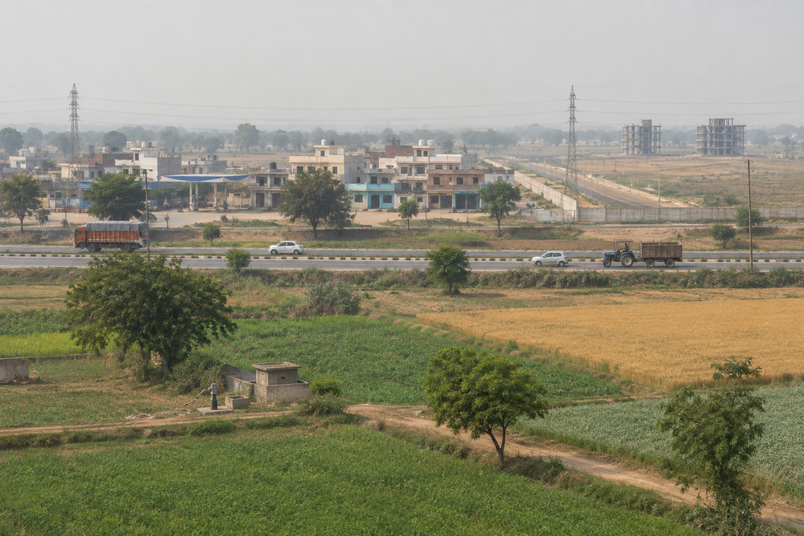
Banur has something Gharuan does not: a notified master plan.
It is one of a dozen settlements GMADA has published an approved plan for, alongside S.A.S Nagar, Kharar, Zirakpur, Dera Bassi, Lalru, Mullanpur, New Chandigarh, Mandi Gobindgarh, Roopnagar, Rajpura and Fatehgarh Sahib. The Banur plan sits on GMADA's own site in three parts: the Plan, the Report, and the Revenue Master Plan. Gharuan, by contrast, has only a draft amendment to the regional plan and no plan of its own.
Banur tehsil is where GMADA's Aerotropolis expansion has been landing, and the plan and the acquisition notices do not describe the same thing.
Two documents govern Banur, not one
The town has its own master plan. It also sits under the GMADA Regional Plan, which GMADA publishes separately and which covers the whole Greater Mohali region.
Those are different instruments at different scales, and amendments happen at both levels. The Gharuan proposal is an amendment to the regional plan. A change to Banur's own zoning is an amendment to the town plan. Anyone tracking what is happening to a parcel here has two documents to watch, not one.
What the town document actually is
The sheet is titled Banur Planning Area, Proposed Land Use 2031, prepared as part of the Master Plan for Greater Mohali Region, with GMADA as client and the Department of Town and Country Planning, Punjab as the approving department.
The consultant was Jurong Consultants Pte Ltd of Singapore, the same firm GMADA appointed for the wider Greater Mohali regional planning exercise and for the Mullanpur Local Planning Area plan. The drawing carries a date of 25 March 2010, a D.T.P. reference dated 5 February 2010, a scale of 1:25,000 on A1, and version 6.1.
Two things follow from that date. The plan is a decade and a half old, working to a 2031 horizon that is now five years away. And GMADA hosts a separate file described as a revised Banur proposed land use plan, which means the version circulating may not be the version in force.
How the zoning is graded
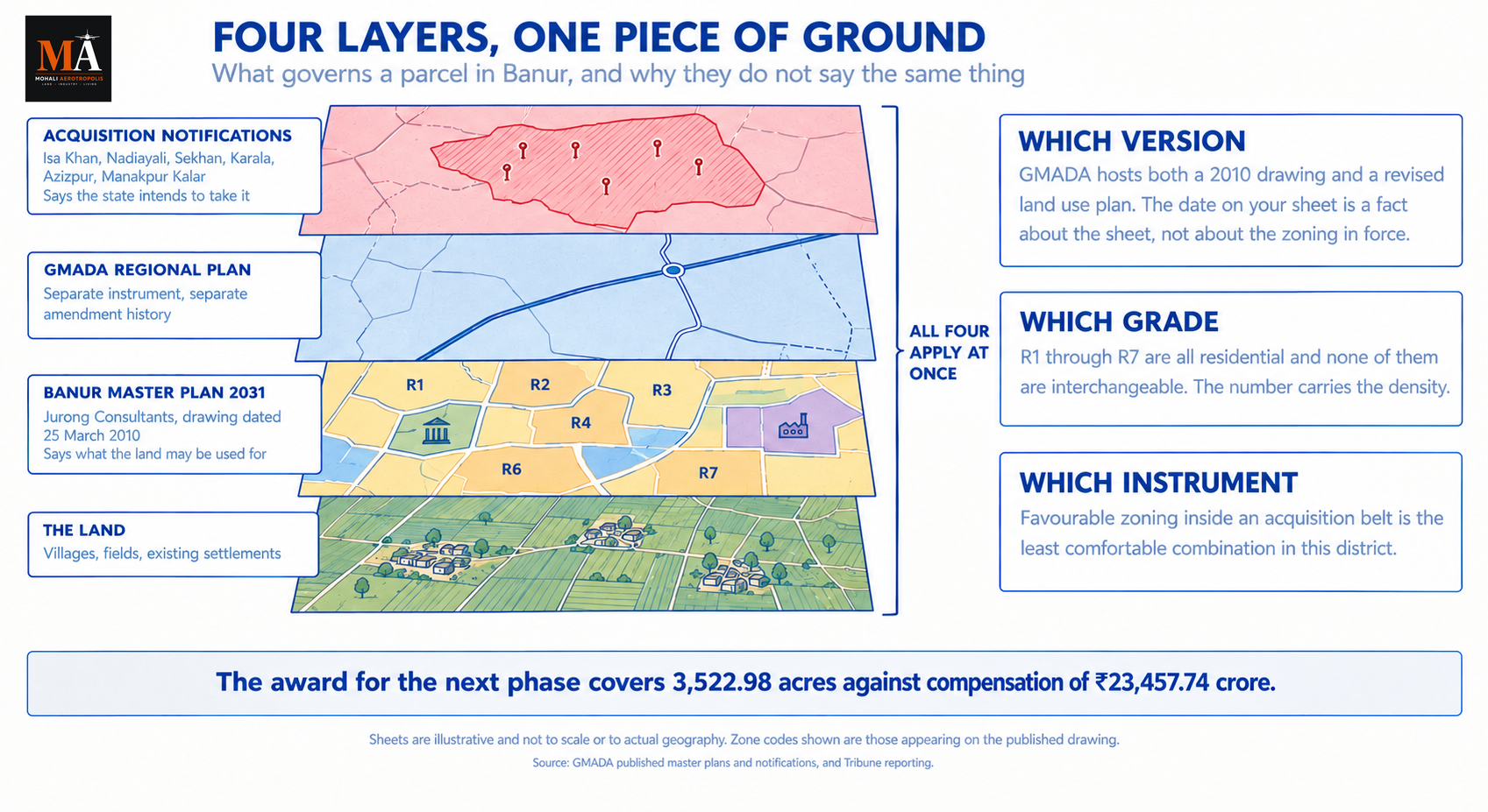
Banur is not zoned in broad blocks. The drawing uses GMADA's graded residential system, and the codes appear across the sheet: R1, R2, R3, R4, R6 and R7, alongside categories for institutional and education, industrial, transport, and agriculture.
A parcel marked R1 and a parcel marked R6 are both residential, and they are not the same permission. The number carries the density the plan allows, which determines how much can be built and therefore what the land is worth to a developer.
So "it is residential on the master plan" is an incomplete statement about any parcel in Banur. The useful question is which residential grade.
Specific area reservations are marked on the sheet as well, with parcels annotated at 100 hectares, 25 hectares and 10 hectares, which is how institutional and large-format uses are carried on a plan of this scale.
The villages on the plan
The drawing names the settlements within the planning area, and that list defines what Banur actually covers.
Mathariap Majra, Kaspur, Kalauli, Ramgarh, Menda Buta Singh, Mazra Wala, Gobinpura, Changeran, Hulka, Nandiali, Rampur, Jalalpur, Ballomajra, Khuri, Jhansli, Ramnagar and Kahlo Majra.
If a property is being sold as Banur and its village is not on that sheet, it may sit outside the planning area, in which case the town master plan does not govern it and the regional plan does.
The road framework the plan was built around
Two alignments define the movement structure on the drawing. PR-1 running to Haryana, the connection eastward out of the planning area, and the MDR to Tepla, with additional PR alignments running through the sheet.
That framework is the reason Banur sits where it does in this region's geography. It is the belt between Mohali and the Haryana boundary, on the road toward Ambala, and the plan was drawn around that role rather than around Chandigarh proximity.
Where the Aerotropolis expansion sits
Here the 2010 document and 2026 reality diverge.
GMADA's Aerotropolis is expanding into Banur tehsil, and the authority's own published notifications name the villages. A Corrigendum Notification Regarding Village Isa Khan, Tehsil Banur, District SAS Nagar sits on GMADA's notifications page, alongside a Public notice regarding Land Acquisition under Aerotropolis Extension SAS Nagar and a Public notice regarding Land Acquisition of Village Nadiayali. Extension notifications have named Sekhan, Karala, Azizpur, Manakpur Kalar, Safipur, Landiali, Dharamgarh, Rurka and Nadiayali.
On acreage, the award for the next phase covers 3,522.98 acres against compensation of ₹23,457.74 crore. Trade reporting has separately put a Banur component at around 2,490 acres, without stating whether that acreage sits inside the award or alongside it.
A master plan and an acquisition notification are different instruments. The plan says what land may be used for. The notification says the state intends to take it. A village can be zoned agricultural on a 2010 plan and be inside an acquisition belt in 2026, and both are true simultaneously. Our guide to the acquisition sections sets out what each stage of that process means.
Reporting also indicates the Banur master plan has been amended to convert parts of agricultural land into residential zoning. That is consistent with the existence of a revised land use plan on GMADA's site.
What the plan does and does not settle
The master plan settles land use. It does not settle whether the state is acquiring your parcel, and favourable zoning inside an acquisition belt is the least comfortable combination available in this district.
It settles which residential grade applies, and R1 through R7 are not interchangeable. A seller describing a parcel as simply residential has not answered the question the plan actually answers.
And it settles nothing at all if you are reading the wrong version. A 2010 drawing and a revised land use plan are two different documents, amendments in this region are issued piecemeal rather than by republishing, and Banur additionally sits under the GMADA Regional Plan, which has its own amendment history. The date on the sheet is a fact about the sheet, not about the zoning in force.
For the pockets of the Aerotropolis that already trade, current rates sit on our LOI price tracker, and every fresh notification affecting this belt is recorded in the notices archive. Live inventory across the Tricity towns is on our Tricity page.
Banur's position has changed since Jurong drew that sheet in 2010. What has not changed is that the plan is the document which decides what any of it can become, and it is free to download from the authority that wrote it.
---
Sources
- Banur (2031) Master Plan, Greater Mohali Area Development Authority, for the approved plan, report and revenue master plan
- Approved Master Plans, GMADA, for the full list of settlements with approved plans and for the GMADA Regional Plan as a separate instrument
- Revised Banur Proposed Land Use Plan, GMADA, for the revised land use drawing
- Banur Planning Area, Proposed Land Use 2031, a published copy of the drawing sheet, for the consultant, the 25 March 2010 date, the 1:25,000 scale, version 6.1, the R1 to R7 zone grading, the village names and the PR-1 and MDR road alignments. The authoritative version is the file on GMADA's own site
- Public notices and acquisition notifications, GMADA, for the corrigendum on village Isa Khan in Tehsil Banur, the Aerotropolis Extension public notice and the notice on village Nadiayali
- GMADA announces awards for 8 villages in Mohali for next phase of Aerotropolis, The Tribune, July 2026, for the 3,522.98 acre award and the compensation figure
बनूर में कुछ ऐसा है जो घरुआन में नहीं है: एक अधिसूचित मास्टर प्लान।
यह उन कई बस्तियों में से एक है जिनके लिए GMADA ने एक स्वीकृत प्लान प्रकाशित किया है, साथ ही S.A.S नगर, खरड़, ज़ीरकपुर, डेरा बस्सी, लालड़ू, मुल्लांपुर, न्यू चंडीगढ़, मंडी गोबिंदगढ़, रूपनगर, राजपुरा और फतेहगढ़ साहिब भी शामिल हैं। बनूर का प्लान GMADA की अपनी साइट पर तीन भागों में मौजूद है: प्लान, रिपोर्ट और रेवेन्यू मास्टर प्लान। इसके विपरीत, घरुआन के पास केवल क्षेत्रीय प्लान में एक ड्राफ्ट संशोधन है और अपना कोई प्लान नहीं है।
बनूर तहसील वह जगह है जहाँ GMADA का Aerotropolis विस्तार हो रहा है, और प्लान तथा अधिग्रहण नोटिस एक ही चीज़ का वर्णन नहीं करते।
बनूर को एक नहीं, दो दस्तावेज़ नियंत्रित करते हैं
शहर का अपना मास्टर प्लान है। यह GMADA रीजनल प्लान के अंतर्गत भी आता है, जिसे GMADA अलग से प्रकाशित करता है और जो पूरे ग्रेटर मोहाली क्षेत्र को कवर करता है।
ये अलग-अलग स्तरों के अलग-अलग उपकरण हैं, और संशोधन दोनों स्तरों पर होते हैं। घरुआन का प्रस्ताव रीजनल प्लान में संशोधन है। बनूर की अपनी ज़ोनिंग में बदलाव टाउन प्लान में संशोधन है। यहाँ किसी पार्सल का क्या हो रहा है इस पर नज़र रखने वाले किसी भी व्यक्ति को एक नहीं, दो दस्तावेज़ों पर नज़र रखनी होगी।
टाउन दस्तावेज़ वास्तव में क्या है
शीट का शीर्षक Banur Planning Area, Proposed Land Use 2031 है, जिसे मास्टर प्लान फॉर ग्रेटर मोहाली रीजन के हिस्से के रूप में तैयार किया गया है, जिसमें GMADA ग्राहक है और पंजाब का डिपार्टमेंट ऑफ टाउन एंड कंट्री प्लानिंग स्वीकृति देने वाला विभाग है।
परामर्शदाता सिंगापुर की Jurong Consultants Pte Ltd थी, वही फर्म जिसे GMADA ने व्यापक ग्रेटर मोहाली क्षेत्रीय योजना अभ्यास और मुल्लांपुर लोकल प्लानिंग एरिया प्लान के लिए नियुक्त किया था। ड्राइंग पर 25 मार्च 2010 की तारीख, 5 फरवरी 2010 का D.T.P. संदर्भ, A1 पर 1:25,000 का स्केल, और संस्करण 6.1 अंकित है।
उस तारीख से दो बातें निकलती हैं। प्लान डेढ़ दशक पुराना है, जो 2031 के लक्ष्य पर काम कर रहा है जो अब पाँच साल दूर है। और GMADA एक अलग फ़ाइल होस्ट करता है जिसे संशोधित बनूर प्रस्तावित भूमि उपयोग प्लान बताया गया है, जिसका मतलब है कि प्रचलित संस्करण वह नहीं हो सकता जो लागू है।
ज़ोनिंग कैसे श्रेणीबद्ध है
बनूर विस्तृत खंडों में ज़ोन नहीं है। ड्राइंग में GMADA की श्रेणीबद्ध आवासीय प्रणाली का उपयोग किया गया है, और कोड पूरी शीट पर दिखाई देते हैं: R1, R2, R3, R4, R6 और R7, साथ ही संस्थागत और शिक्षा, औद्योगिक, परिवहन और कृषि की श्रेणियाँ।
R1 अंकित एक पार्सल और R6 अंकित एक पार्सल दोनों आवासीय हैं, और वे एक ही अनुमति नहीं हैं। संख्या वह घनत्व बताती है जिसकी प्लान अनुमति देता है, जो यह निर्धारित करता है कि कितना निर्माण हो सकता है और इसलिए एक डेवलपर के लिए भूमि का मूल्य क्या है।
इसलिए "यह मास्टर प्लान पर आवासीय है" बनूर में किसी भी पार्सल के बारे में एक अपूर्ण कथन है। उपयोगी प्रश्न यह है कि कौन सी आवासीय श्रेणी।
विशिष्ट क्षेत्र आरक्षण भी शीट पर अंकित हैं, जिनमें पार्सल 100 हेक्टेयर, 25 हेक्टेयर और 10 हेक्टेयर पर एनोटेट किए गए हैं, जो इस पैमाने के प्लान पर संस्थागत और बड़े-प्रारूप उपयोगों को दर्शाने का तरीका है।
प्लान पर मौजूद गाँव
ड्राइंग में प्लानिंग एरिया के भीतर की बस्तियों के नाम हैं, और वह सूची परिभाषित करती है कि बनूर वास्तव में क्या कवर करता है।
मथारियाप माजरा, कसपुर, कलौली, रामगढ़, मेंदा बूटा सिंह, माजरा वाला, गोबिंदपुरा, चंगेरन, हुल्का, नंदियाली, रामपुर, जलालपुर, बल्लोमाजरा, खुरी, झांसली, रामनगर और काहलो माजरा।
अगर किसी संपत्ति को बनूर के रूप में बेचा जा रहा है और उसका गाँव उस शीट पर नहीं है, तो वह प्लानिंग एरिया के बाहर हो सकती है, जिस स्थिति में टाउन मास्टर प्लान उसे नियंत्रित नहीं करता और रीजनल प्लान करता है।
सड़क ढाँचा जिसके इर्द-गिर्द प्लान बना था
दो अलाइनमेंट ड्राइंग पर मूवमेंट स्ट्रक्चर को परिभाषित करते हैं। PR-1 जो हरियाणा की ओर जाती है, प्लानिंग एरिया से पूर्व की ओर जाने वाला कनेक्शन, और MDR से टेपला, साथ ही शीट के माध्यम से जाती अतिरिक्त PR अलाइनमेंट।
वह ढाँचा ही कारण है कि इस क्षेत्र के भूगोल में बनूर जहाँ है वहाँ स्थित है। यह मोहाली और हरियाणा सीमा के बीच की पट्टी है, अंबाला की ओर जाने वाली सड़क पर, और प्लान चंडीगढ़ निकटता के बजाय उस भूमिका के इर्द-गिर्द बनाया गया था।
Aerotropolis विस्तार कहाँ स्थित है
यहाँ 2010 का दस्तावेज़ और 2026 की वास्तविकता अलग हो जाते हैं।
GMADA का Aerotropolis बनूर तहसील में फैल रहा है, और प्राधिकरण की अपनी प्रकाशित अधिसूचनाएँ गाँवों के नाम बताती हैं। Corrigendum Notification Regarding Village Isa Khan, Tehsil Banur, District SAS Nagar GMADA के नोटिफिकेशन पेज पर मौजूद है, साथ ही Public notice regarding Land Acquisition under Aerotropolis Extension SAS Nagar और Public notice regarding Land Acquisition of Village Nadiayali भी। विस्तार अधिसूचनाओं में सेखान, कराला, अज़ीज़पुर, मानकपुर कलार, सफीपुर, लंदियाली, धरमगढ़, रुरका और नदियाली के नाम दिए गए हैं।
रकबे के संदर्भ में, अगले चरण का अवार्ड ₹23,457.74 करोड़ के मुआवज़े के मुकाबले 3,522.98 एकड़ को कवर करता है। व्यापार रिपोर्टिंग ने अलग से बनूर घटक को लगभग 2,490 एकड़ बताया है, बिना यह बताए कि वह रकबा अवार्ड के भीतर है या उसके साथ।
एक मास्टर प्लान और एक अधिग्रहण अधिसूचना अलग-अलग उपकरण हैं। प्लान बताता है कि भूमि का उपयोग किस लिए किया जा सकता है। अधिसूचना बताती है कि राज्य इसे लेने का इरादा रखता है। एक गाँव 2010 के प्लान पर कृषि के रूप में ज़ोन किया जा सकता है और 2026 में अधिग्रहण पट्टी के भीतर हो सकता है, और दोनों एक साथ सत्य हैं। हमारी अधिग्रहण धाराओं की मार्गदर्शिका बताती है कि उस प्रक्रिया के प्रत्येक चरण का क्या अर्थ है।
रिपोर्टिंग यह भी संकेत देती है कि बनूर मास्टर प्लान में कृषि भूमि के कुछ हिस्सों को आवासीय ज़ोनिंग में बदलने के लिए संशोधन किया गया है। यह GMADA की साइट पर एक संशोधित भूमि उपयोग प्लान के अस्तित्व के अनुरूप है।
प्लान क्या तय करता है और क्या नहीं
मास्टर प्लान भूमि उपयोग तय करता है। यह तय नहीं करता कि राज्य आपका पार्सल अधिग्रहित कर रहा है या नहीं, और अधिग्रहण पट्टी के भीतर अनुकूल ज़ोनिंग इस जिले में उपलब्ध सबसे असहज संयोजन है।
यह तय करता है कि कौन सी आवासीय श्रेणी लागू होती है, और R1 से R7 विनिमेय नहीं हैं। किसी पार्सल को केवल आवासीय बताने वाले विक्रेता ने उस प्रश्न का उत्तर नहीं दिया है जिसका उत्तर प्लान वास्तव में देता है।
और अगर आप गलत संस्करण पढ़ रहे हैं तो यह कुछ भी तय नहीं करता। 2010 की ड्राइंग और एक संशोधित भूमि उपयोग प्लान दो अलग दस्तावेज़ हैं, इस क्षेत्र में संशोधन पुनःप्रकाशन के बजाय टुकड़ों में जारी किए जाते हैं, और बनूर अतिरिक्त रूप से GMADA रीजनल प्लान के अंतर्गत आता है, जिसका अपना संशोधन इतिहास है। शीट पर की तारीख शीट के बारे में एक तथ्य है, लागू ज़ोनिंग के बारे में नहीं।
Aerotropolis के जिन पॉकेट्स का पहले से कारोबार होता है, उनके वर्तमान रेट हमारे LOI प्राइस ट्रैकर पर हैं, और इस पट्टी को प्रभावित करने वाली हर नई अधिसूचना नोटिस आर्काइव में दर्ज है। ट्रिसिटी शहरों में लाइव इन्वेंटरी हमारे ट्रिसिटी पेज पर है।
2010 में जुरोंग द्वारा उस शीट को बनाए जाने के बाद से बनूर की स्थिति बदल गई है। जो नहीं बदला है वह यह है कि प्लान वह दस्तावेज़ है जो तय करता है कि इसमें से कुछ भी क्या बन सकता है, और इसे उस प्राधिकरण से मुफ्त डाउनलोड किया जा सकता है जिसने इसे लिखा था।
---
स्रोत
- Banur (2031) Master Plan, ग्रेटर मोहाली एरिया डेवलपमेंट अथॉरिटी, स्वीकृत प्लान, रिपोर्ट और रेवेन्यू मास्टर प्लान के लिए
- Approved Master Plans, GMADA, स्वीकृत प्लान वाली बस्तियों की पूरी सूची और एक अलग उपकरण के रूप में GMADA रीजनल प्लान के लिए
- Revised Banur Proposed Land Use Plan, GMADA, संशोधित भूमि उपयोग ड्राइंग के लिए
- Banur Planning Area, Proposed Land Use 2031, ड्राइंग शीट की एक प्रकाशित प्रति, परामर्शदाता, 25 मार्च 2010 की तारीख, 1:25,000 स्केल, संस्करण 6.1, R1 से R7 ज़ोन ग्रेडिंग, गाँवों के नाम और PR-1 तथा MDR सड़क अलाइनमेंट के लिए। आधिकारिक संस्करण GMADA की अपनी साइट पर मौजूद फ़ाइल है
- Public notices and acquisition notifications, GMADA, तहसील बनूर के गाँव ईसा खान पर कोरिजेंडम, Aerotropolis एक्सटेंशन सार्वजनिक नोटिस और गाँव नदियाली पर नोटिस के लिए
- GMADA announces awards for 8 villages in Mohali for next phase of Aerotropolis, द ट्रिब्यून, जुलाई 2026, 3,522.98 एकड़ के अवार्ड और मुआवज़ा राशि के लिए
ਬਨੂਰ ਕੋਲ ਉਹ ਚੀਜ਼ ਹੈ ਜੋ ਘੜੂੰਆਂ ਕੋਲ ਨਹੀਂ: ਇੱਕ ਨੋਟੀਫਾਈਡ ਮਾਸਟਰ ਪਲਾਨ।
ਇਹ ਉਨ੍ਹਾਂ ਦਰਜਨ ਭਰ ਬਸਤੀਆਂ ਵਿੱਚੋਂ ਇੱਕ ਹੈ ਜਿਨ੍ਹਾਂ ਲਈ GMADA ਨੇ ਮਨਜ਼ੂਰਸ਼ੁਦਾ ਪਲਾਨ ਪ੍ਰਕਾਸ਼ਿਤ ਕੀਤਾ ਹੈ, ਜਿਨ੍ਹਾਂ ਵਿੱਚ S.A.S Nagar, ਖਰੜ, ਜ਼ੀਰਕਪੁਰ, ਡੇਰਾ ਬੱਸੀ, ਲਾਲੜੂ, ਮੁੱਲਾਂਪੁਰ, ਨਿਊ ਚੰਡੀਗੜ੍ਹ, ਮੰਡੀ ਗੋਬਿੰਦਗੜ੍ਹ, ਰੂਪਨਗਰ, ਰਾਜਪੁਰਾ ਅਤੇ ਫਤਹਿਗੜ੍ਹ ਸਾਹਿਬ ਸ਼ਾਮਲ ਹਨ। ਬਨੂਰ ਦਾ ਪਲਾਨ GMADA ਦੀ ਆਪਣੀ ਸਾਈਟ 'ਤੇ ਤਿੰਨ ਭਾਗਾਂ ਵਿੱਚ ਹੈ: ਪਲਾਨ, ਰਿਪੋਰਟ, ਅਤੇ ਰੈਵੇਨਿਊ ਮਾਸਟਰ ਪਲਾਨ। ਇਸ ਦੇ ਉਲਟ, ਘੜੂੰਆਂ ਕੋਲ ਸਿਰਫ਼ ਖੇਤਰੀ ਪਲਾਨ ਵਿੱਚ ਇੱਕ ਡਰਾਫਟ ਸੋਧ ਹੈ ਅਤੇ ਆਪਣਾ ਕੋਈ ਪਲਾਨ ਨਹੀਂ।
ਬਨੂਰ ਤਹਿਸੀਲ ਉਹ ਥਾਂ ਹੈ ਜਿੱਥੇ GMADA ਦਾ Aerotropolis ਵਿਸਥਾਰ ਪਹੁੰਚ ਰਿਹਾ ਹੈ, ਅਤੇ ਪਲਾਨ ਅਤੇ ਐਕਵਿਜ਼ੀਸ਼ਨ ਨੋਟਿਸ ਇੱਕੋ ਚੀਜ਼ ਦਾ ਵਰਣਨ ਨਹੀਂ ਕਰਦੇ।
ਬਨੂਰ ਨੂੰ ਇੱਕ ਨਹੀਂ, ਦੋ ਦਸਤਾਵੇਜ਼ ਚਲਾਉਂਦੇ ਹਨ
ਕਸਬੇ ਦਾ ਆਪਣਾ ਮਾਸਟਰ ਪਲਾਨ ਹੈ। ਇਹ GMADA ਖੇਤਰੀ ਪਲਾਨ ਦੇ ਅਧੀਨ ਵੀ ਆਉਂਦਾ ਹੈ, ਜੋ GMADA ਵੱਖਰੇ ਤੌਰ 'ਤੇ ਪ੍ਰਕਾਸ਼ਿਤ ਕਰਦੀ ਹੈ ਅਤੇ ਜੋ ਪੂਰੇ ਗ੍ਰੇਟਰ ਮੋਹਾਲੀ ਖੇਤਰ ਨੂੰ ਕਵਰ ਕਰਦਾ ਹੈ।
ਇਹ ਵੱਖ-ਵੱਖ ਪੈਮਾਨਿਆਂ 'ਤੇ ਵੱਖ-ਵੱਖ ਸਾਧਨ ਹਨ, ਅਤੇ ਸੋਧਾਂ ਦੋਵਾਂ ਪੱਧਰਾਂ 'ਤੇ ਹੁੰਦੀਆਂ ਹਨ। ਘੜੂੰਆਂ ਪ੍ਰਸਤਾਵ ਖੇਤਰੀ ਪਲਾਨ ਵਿੱਚ ਇੱਕ ਸੋਧ ਹੈ। ਬਨੂਰ ਦੀ ਆਪਣੀ ਜ਼ੋਨਿੰਗ ਵਿੱਚ ਤਬਦੀਲੀ ਕਸਬਾ ਪਲਾਨ ਵਿੱਚ ਇੱਕ ਸੋਧ ਹੈ। ਇੱਥੇ ਕਿਸੇ ਪਲਾਟ ਨਾਲ ਕੀ ਹੋ ਰਿਹਾ ਹੈ ਇਸਦੀ ਨਿਗਰਾਨੀ ਕਰਨ ਵਾਲੇ ਕਿਸੇ ਵੀ ਵਿਅਕਤੀ ਨੂੰ ਇੱਕ ਨਹੀਂ, ਦੋ ਦਸਤਾਵੇਜ਼ ਦੇਖਣੇ ਪੈਣਗੇ।
ਕਸਬਾ ਦਸਤਾਵੇਜ਼ ਅਸਲ ਵਿੱਚ ਕੀ ਹੈ
ਸ਼ੀਟ ਦਾ ਸਿਰਲੇਖ Banur Planning Area, Proposed Land Use 2031 ਹੈ, ਜੋ ਗ੍ਰੇਟਰ ਮੋਹਾਲੀ ਖੇਤਰ ਲਈ ਮਾਸਟਰ ਪਲਾਨ ਦੇ ਹਿੱਸੇ ਵਜੋਂ ਤਿਆਰ ਕੀਤੀ ਗਈ ਹੈ, ਜਿਸ ਵਿੱਚ GMADA ਗਾਹਕ ਹੈ ਅਤੇ Department of Town and Country Planning, Punjab ਮਨਜ਼ੂਰੀ ਦੇਣ ਵਾਲਾ ਵਿਭਾਗ ਹੈ।
ਸਲਾਹਕਾਰ ਸਿੰਗਾਪੁਰ ਦੀ Jurong Consultants Pte Ltd ਸੀ, ਉਹੀ ਫਰਮ ਜਿਸਨੂੰ GMADA ਨੇ ਵਿਆਪਕ ਗ੍ਰੇਟਰ ਮੋਹਾਲੀ ਖੇਤਰੀ ਪਲਾਨਿੰਗ ਅਭਿਆਸ ਅਤੇ ਮੁੱਲਾਂਪੁਰ ਲੋਕਲ ਪਲਾਨਿੰਗ ਏਰੀਆ ਪਲਾਨ ਲਈ ਨਿਯੁਕਤ ਕੀਤਾ ਸੀ। ਡਰਾਇੰਗ 'ਤੇ 25 ਮਾਰਚ 2010 ਦੀ ਤਾਰੀਖ਼, 5 ਫਰਵਰੀ 2010 ਦਾ D.T.P. ਹਵਾਲਾ, A1 'ਤੇ 1:25,000 ਦਾ ਪੈਮਾਨਾ, ਅਤੇ ਵਰਜ਼ਨ 6.1 ਦਰਜ ਹੈ।
ਉਸ ਤਾਰੀਖ਼ ਤੋਂ ਦੋ ਗੱਲਾਂ ਨਿਕਲਦੀਆਂ ਹਨ। ਪਲਾਨ ਡੇਢ ਦਹਾਕੇ ਪੁਰਾਣਾ ਹੈ, ਜੋ 2031 ਦੇ ਟੀਚੇ 'ਤੇ ਕੰਮ ਕਰ ਰਿਹਾ ਹੈ ਜੋ ਹੁਣ ਪੰਜ ਸਾਲ ਦੂਰ ਹੈ। ਅਤੇ GMADA ਇੱਕ ਵੱਖਰੀ ਫਾਈਲ ਹੋਸਟ ਕਰਦੀ ਹੈ ਜਿਸਨੂੰ revised ਬਨੂਰ ਪ੍ਰਸਤਾਵਿਤ ਲੈਂਡ ਯੂਜ਼ ਪਲਾਨ ਦੱਸਿਆ ਗਿਆ ਹੈ, ਜਿਸਦਾ ਮਤਲਬ ਹੈ ਕਿ ਘੁੰਮ ਰਿਹਾ ਵਰਜ਼ਨ ਸ਼ਾਇਦ ਲਾਗੂ ਵਰਜ਼ਨ ਨਾ ਹੋਵੇ।
ਜ਼ੋਨਿੰਗ ਕਿਵੇਂ ਦਰਜਾਬੰਦ ਹੈ
ਬਨੂਰ ਵਿਆਪਕ ਬਲਾਕਾਂ ਵਿੱਚ ਜ਼ੋਨ ਨਹੀਂ ਕੀਤਾ ਗਿਆ। ਡਰਾਇੰਗ GMADA ਦੀ ਦਰਜਾਬੰਦ ਰਿਹਾਇਸ਼ੀ ਪ੍ਰਣਾਲੀ ਵਰਤਦੀ ਹੈ, ਅਤੇ ਕੋਡ ਪੂਰੀ ਸ਼ੀਟ 'ਤੇ ਦਿਖਾਈ ਦਿੰਦੇ ਹਨ: R1, R2, R3, R4, R6 and R7, ਨਾਲ ਹੀ ਸੰਸਥਾਗਤ ਅਤੇ ਸਿੱਖਿਆ, ਉਦਯੋਗਿਕ, ਟਰਾਂਸਪੋਰਟ, ਅਤੇ ਖੇਤੀਬਾੜੀ ਲਈ ਸ਼੍ਰੇਣੀਆਂ।
R1 ਵਜੋਂ ਨਿਸ਼ਾਨਬੱਧ ਪਲਾਟ ਅਤੇ R6 ਵਜੋਂ ਨਿਸ਼ਾਨਬੱਧ ਪਲਾਟ ਦੋਵੇਂ ਰਿਹਾਇਸ਼ੀ ਹਨ, ਅਤੇ ਇਹ ਇੱਕੋ ਇਜਾਜ਼ਤ ਨਹੀਂ ਹਨ। ਨੰਬਰ ਉਹ ਘਣਤਾ ਰੱਖਦਾ ਹੈ ਜੋ ਪਲਾਨ ਇਜਾਜ਼ਤ ਦਿੰਦਾ ਹੈ, ਜੋ ਨਿਰਧਾਰਤ ਕਰਦਾ ਹੈ ਕਿ ਕਿੰਨਾ ਬਣਾਇਆ ਜਾ ਸਕਦਾ ਹੈ ਅਤੇ ਇਸ ਲਈ ਇੱਕ ਡਿਵੈਲਪਰ ਲਈ ਜ਼ਮੀਨ ਦੀ ਕੀਮਤ ਕੀ ਹੈ।
ਇਸ ਲਈ "ਇਹ ਮਾਸਟਰ ਪਲਾਨ 'ਤੇ ਰਿਹਾਇਸ਼ੀ ਹੈ" ਬਨੂਰ ਵਿੱਚ ਕਿਸੇ ਵੀ ਪਲਾਟ ਬਾਰੇ ਇੱਕ ਅਧੂਰਾ ਬਿਆਨ ਹੈ। ਲਾਭਦਾਇਕ ਸਵਾਲ ਇਹ ਹੈ ਕਿ ਕਿਹੜਾ ਰਿਹਾਇਸ਼ੀ ਗ੍ਰੇਡ।
ਖਾਸ ਖੇਤਰ ਰਿਜ਼ਰਵੇਸ਼ਨ ਵੀ ਸ਼ੀਟ 'ਤੇ ਨਿਸ਼ਾਨਬੱਧ ਹਨ, ਜਿਸ ਵਿੱਚ ਪਲਾਟ 100 ਹੈਕਟੇਅਰ, 25 ਹੈਕਟੇਅਰ ਅਤੇ 10 ਹੈਕਟੇਅਰ 'ਤੇ ਐਨੋਟੇਟ ਕੀਤੇ ਗਏ ਹਨ, ਜੋ ਇਸ ਪੈਮਾਨੇ ਦੇ ਪਲਾਨ 'ਤੇ ਸੰਸਥਾਗਤ ਅਤੇ ਵੱਡੇ ਫਾਰਮੈਟ ਵਾਲੇ ਉਪਯੋਗ ਕਿਵੇਂ ਰੱਖੇ ਜਾਂਦੇ ਹਨ।
ਪਲਾਨ 'ਤੇ ਪਿੰਡ
ਡਰਾਇੰਗ ਪਲਾਨਿੰਗ ਏਰੀਆ ਦੇ ਅੰਦਰ ਬਸਤੀਆਂ ਦੇ ਨਾਮ ਦੱਸਦੀ ਹੈ, ਅਤੇ ਉਹ ਸੂਚੀ ਪਰਿਭਾਸ਼ਿਤ ਕਰਦੀ ਹੈ ਕਿ ਬਨੂਰ ਅਸਲ ਵਿੱਚ ਕੀ ਕਵਰ ਕਰਦਾ ਹੈ।
ਮਥਾਰੀਆਪ ਮਾਜਰਾ, ਕਸਪੁਰ, ਕਲੌਲੀ, ਰਾਮਗੜ੍ਹ, ਮੇਂਦਾ ਬੂਟਾ ਸਿੰਘ, ਮਾਜਰਾ ਵਾਲਾ, ਗੋਬਿੰਦਪੁਰਾ, ਚੰਗੇਰਾਂ, ਹੁਲਕਾ, ਨੰਦਿਆਲੀ, ਰਾਮਪੁਰ, ਜਲਾਲਪੁਰ, ਬੱਲੋਮਾਜਰਾ, ਖੁਰੀ, ਝਾਂਸਲੀ, ਰਾਮਨਗਰ ਅਤੇ ਕਾਹਲੋ ਮਾਜਰਾ।
ਜੇਕਰ ਕੋਈ ਜਾਇਦਾਦ ਬਨੂਰ ਵਜੋਂ ਵੇਚੀ ਜਾ ਰਹੀ ਹੈ ਅਤੇ ਉਸਦਾ ਪਿੰਡ ਉਸ ਸ਼ੀਟ 'ਤੇ ਨਹੀਂ ਹੈ, ਤਾਂ ਇਹ ਪਲਾਨਿੰਗ ਏਰੀਆ ਤੋਂ ਬਾਹਰ ਹੋ ਸਕਦੀ ਹੈ, ਜਿਸ ਸਥਿਤੀ ਵਿੱਚ ਕਸਬਾ ਮਾਸਟਰ ਪਲਾਨ ਇਸਨੂੰ ਨਹੀਂ ਚਲਾਉਂਦਾ ਅਤੇ ਖੇਤਰੀ ਪਲਾਨ ਚਲਾਉਂਦਾ ਹੈ।
ਉਹ ਸੜਕ ਢਾਂਚਾ ਜਿਸਦੇ ਆਲੇ-ਦੁਆਲੇ ਪਲਾਨ ਬਣਾਇਆ ਗਿਆ ਸੀ
ਦੋ ਅਲਾਈਨਮੈਂਟ ਡਰਾਇੰਗ 'ਤੇ ਆਵਾਜਾਈ ਢਾਂਚੇ ਨੂੰ ਪਰਿਭਾਸ਼ਿਤ ਕਰਦੇ ਹਨ। PR-1 running to Haryana, ਪਲਾਨਿੰਗ ਏਰੀਆ ਤੋਂ ਪੂਰਬ ਵੱਲ ਜੋੜ, ਅਤੇ MDR to Tepla, ਨਾਲ ਹੀ ਸ਼ੀਟ ਵਿੱਚੋਂ ਲੰਘਦੇ ਵਾਧੂ PR ਅਲਾਈਨਮੈਂਟ।
ਉਹ ਢਾਂਚਾ ਕਾਰਨ ਹੈ ਕਿ ਬਨੂਰ ਇਸ ਖੇਤਰ ਦੇ ਭੂਗੋਲ ਵਿੱਚ ਜਿੱਥੇ ਹੈ ਉੱਥੇ ਕਿਉਂ ਹੈ। ਇਹ ਮੋਹਾਲੀ ਅਤੇ ਹਰਿਆਣਾ ਸੀਮਾ ਵਿਚਕਾਰ ਪੱਟੀ ਹੈ, ਅੰਬਾਲਾ ਵੱਲ ਸੜਕ 'ਤੇ, ਅਤੇ ਪਲਾਨ ਉਸ ਭੂਮਿਕਾ ਦੇ ਆਲੇ-ਦੁਆਲੇ ਬਣਾਇਆ ਗਿਆ ਸੀ ਨਾ ਕਿ ਚੰਡੀਗੜ੍ਹ ਨੇੜਤਾ ਦੇ ਆਲੇ-ਦੁਆਲੇ।
Aerotropolis ਵਿਸਥਾਰ ਕਿੱਥੇ ਬੈਠਦਾ ਹੈ
ਇੱਥੇ 2010 ਦਾ ਦਸਤਾਵੇਜ਼ ਅਤੇ 2026 ਦੀ ਅਸਲੀਅਤ ਵੱਖ ਹੋ ਜਾਂਦੇ ਹਨ।
GMADA ਦਾ Aerotropolis ਬਨੂਰ ਤਹਿਸੀਲ ਵਿੱਚ ਫੈਲ ਰਿਹਾ ਹੈ, ਅਤੇ ਅਥਾਰਟੀ ਦੇ ਆਪਣੇ ਪ੍ਰਕਾਸ਼ਿਤ ਨੋਟਿਸ ਪਿੰਡਾਂ ਦੇ ਨਾਮ ਦੱਸਦੇ ਹਨ। ਇੱਕ Corrigendum Notification Regarding Village Isa Khan, Tehsil Banur, District SAS Nagar GMADA ਦੇ ਨੋਟਿਸ ਪੇਜ 'ਤੇ ਹੈ, ਨਾਲ ਹੀ ਇੱਕ Public notice regarding Land Acquisition under Aerotropolis Extension SAS Nagar ਅਤੇ ਇੱਕ Public notice regarding Land Acquisition of Village Nadiayali। ਐਕਸਟੈਂਸ਼ਨ ਨੋਟਿਸਾਂ ਵਿੱਚ ਸੇਖਾਂ, ਕਰਾਲਾ, ਅਜ਼ੀਜ਼ਪੁਰ, ਮਾਨਕਪੁਰ ਕਲਰ, ਸਫੀਪੁਰ, ਲਾਂਦਿਆਲੀ, ਧਰਮਗੜ੍ਹ, ਰੁੜਕਾ ਅਤੇ ਨਦਿਆਲੀ ਦੇ ਨਾਮ ਦਿੱਤੇ ਗਏ ਹਨ।
ਏਕੜ ਦੇ ਹਿਸਾਬ ਨਾਲ, ਅਗਲੇ ਪੜਾਅ ਲਈ ਅਵਾਰਡ 3,522.98 ਏਕੜ ਨੂੰ ਕਵਰ ਕਰਦਾ ਹੈ ਜਿਸਦੇ ਮੁਆਵਜ਼ੇ ਵਜੋਂ ₹23,457.74 ਕਰੋੜ ਹੈ। ਵਪਾਰਕ ਰਿਪੋਰਟਿੰਗ ਨੇ ਵੱਖਰੇ ਤੌਰ 'ਤੇ ਬਨੂਰ ਦੇ ਹਿੱਸੇ ਨੂੰ ਲਗਭਗ 2,490 ਏਕੜ ਦੱਸਿਆ ਹੈ, ਬਿਨਾਂ ਇਹ ਦੱਸੇ ਕਿ ਉਹ ਏਕੜ ਅਵਾਰਡ ਦੇ ਅੰਦਰ ਹੈ ਜਾਂ ਉਸਦੇ ਨਾਲ।
ਇੱਕ ਮਾਸਟਰ ਪਲਾਨ ਅਤੇ ਇੱਕ ਐਕਵਿਜ਼ੀਸ਼ਨ ਨੋਟਿਸ ਵੱਖਰੇ ਸਾਧਨ ਹਨ। ਪਲਾਨ ਦੱਸਦਾ ਹੈ ਕਿ ਜ਼ਮੀਨ ਕਿਸ ਲਈ ਵਰਤੀ ਜਾ ਸਕਦੀ ਹੈ। ਨੋਟਿਸ ਦੱਸਦਾ ਹੈ ਕਿ ਰਾਜ ਇਸਨੂੰ ਲੈਣ ਦਾ ਇਰਾਦਾ ਰੱਖਦਾ ਹੈ। ਇੱਕ ਪਿੰਡ 2010 ਦੇ ਪਲਾਨ 'ਤੇ ਖੇਤੀਬਾੜੀ ਵਜੋਂ ਜ਼ੋਨ ਕੀਤਾ ਹੋ ਸਕਦਾ ਹੈ ਅਤੇ 2026 ਵਿੱਚ ਐਕਵਿਜ਼ੀਸ਼ਨ ਪੱਟੀ ਦੇ ਅੰਦਰ ਹੋ ਸਕਦਾ ਹੈ, ਅਤੇ ਦੋਵੇਂ ਇੱਕੋ ਸਮੇਂ ਸੱਚ ਹਨ। ਸਾਡੀ ਐਕਵਿਜ਼ੀਸ਼ਨ ਸੈਕਸ਼ਨਾਂ ਦੀ ਗਾਈਡ ਦੱਸਦੀ ਹੈ ਕਿ ਉਸ ਪ੍ਰਕਿਰਿਆ ਦੇ ਹਰ ਪੜਾਅ ਦਾ ਕੀ ਮਤਲਬ ਹੈ।
ਰਿਪੋਰਟਿੰਗ ਇਹ ਵੀ ਦਰਸਾਉਂਦੀ ਹੈ ਕਿ ਬਨੂਰ ਮਾਸਟਰ ਪਲਾਨ ਵਿੱਚ ਖੇਤੀਬਾੜੀ ਜ਼ਮੀਨ ਦੇ ਕੁਝ ਹਿੱਸਿਆਂ ਨੂੰ ਰਿਹਾਇਸ਼ੀ ਜ਼ੋਨਿੰਗ ਵਿੱਚ ਬਦਲਣ ਲਈ ਸੋਧ ਕੀਤੀ ਗਈ ਹੈ। ਇਹ GMADA ਦੀ ਸਾਈਟ 'ਤੇ ਸੋਧੇ ਹੋਏ ਲੈਂਡ ਯੂਜ਼ ਪਲਾਨ ਦੇ ਹੋਣ ਨਾਲ ਮੇਲ ਖਾਂਦਾ ਹੈ।
ਪਲਾਨ ਕੀ ਤੈਅ ਕਰਦਾ ਹੈ ਅਤੇ ਕੀ ਨਹੀਂ
ਮਾਸਟਰ ਪਲਾਨ ਜ਼ਮੀਨ ਦੀ ਵਰਤੋਂ ਤੈਅ ਕਰਦਾ ਹੈ। ਇਹ ਤੈਅ ਨਹੀਂ ਕਰਦਾ ਕਿ ਰਾਜ ਤੁਹਾਡਾ ਪਲਾਟ ਲੈ ਰਿਹਾ ਹੈ ਜਾਂ ਨਹੀਂ, ਅਤੇ ਐਕਵਿਜ਼ੀਸ਼ਨ ਪੱਟੀ ਦੇ ਅੰਦਰ ਅਨੁਕੂਲ ਜ਼ੋਨਿੰਗ ਇਸ ਜ਼ਿਲ੍ਹੇ ਵਿੱਚ ਉਪਲਬਧ ਸਭ ਤੋਂ ਘੱਟ ਆਰਾਮਦੇਹ ਸੰਜੋਗ ਹੈ।
ਇਹ ਤੈਅ ਕਰਦਾ ਹੈ ਕਿ ਕਿਹੜਾ ਰਿਹਾਇਸ਼ੀ ਗ੍ਰੇਡ ਲਾਗੂ ਹੁੰਦਾ ਹੈ, ਅਤੇ R1 ਤੋਂ R7 ਆਪਸ ਵਿੱਚ ਬਦਲਣਯੋਗ ਨਹੀਂ ਹਨ। ਇੱਕ ਵਿਕਰੇਤਾ ਜੋ ਪਲਾਟ ਨੂੰ ਸਿਰਫ਼ ਰਿਹਾਇਸ਼ੀ ਦੱਸਦਾ ਹੈ ਉਸਨੇ ਉਸ ਸਵਾਲ ਦਾ ਜਵਾਬ ਨਹੀਂ ਦਿੱਤਾ ਜੋ ਪਲਾਨ ਅਸਲ ਵਿੱਚ ਜਵਾਬ ਦਿੰਦਾ ਹੈ।
ਅਤੇ ਇਹ ਕੁਝ ਵੀ ਤੈਅ ਨਹੀਂ ਕਰਦਾ ਜੇਕਰ ਤੁਸੀਂ ਗਲਤ ਵਰਜ਼ਨ ਪੜ੍ਹ ਰਹੇ ਹੋ। ਇੱਕ 2010 ਦੀ ਡਰਾਇੰਗ ਅਤੇ ਇੱਕ ਸੋਧਿਆ ਹੋਇਆ ਲੈਂਡ ਯੂਜ਼ ਪਲਾਨ ਦੋ ਵੱਖਰੇ ਦਸਤਾਵੇਜ਼ ਹਨ, ਇਸ ਖੇਤਰ ਵਿੱਚ ਸੋਧਾਂ ਦੁਬਾਰਾ ਪ੍ਰਕਾਸ਼ਿਤ ਕਰਨ ਦੀ ਬਜਾਏ ਟੁਕੜਿਆਂ ਵਿੱਚ ਜਾਰੀ ਕੀਤੀਆਂ ਜਾਂਦੀਆਂ ਹਨ, ਅਤੇ ਬਨੂਰ ਵਾਧੂ ਤੌਰ 'ਤੇ GMADA ਖੇਤਰੀ ਪਲਾਨ ਦੇ ਅਧੀਨ ਆਉਂਦਾ ਹੈ, ਜਿਸਦਾ ਆਪਣਾ ਸੋਧ ਇਤਿਹਾਸ ਹੈ। ਸ਼ੀਟ 'ਤੇ ਤਾਰੀਖ਼ ਸ਼ੀਟ ਬਾਰੇ ਇੱਕ ਤੱਥ ਹੈ, ਲਾਗੂ ਜ਼ੋਨਿੰਗ ਬਾਰੇ ਨਹੀਂ।
Aerotropolis ਦੇ ਉਨ੍ਹਾਂ ਪਾਕਿਟਾਂ ਲਈ ਜੋ ਪਹਿਲਾਂ ਹੀ ਵਪਾਰ ਕਰਦੇ ਹਨ, ਮੌਜੂਦਾ ਰੇਟ ਸਾਡੇ LOI price tracker 'ਤੇ ਹਨ, ਅਤੇ ਇਸ ਪੱਟੀ ਨੂੰ ਪ੍ਰਭਾਵਿਤ ਕਰਨ ਵਾਲਾ ਹਰ ਨਵਾਂ ਨੋਟਿਸ notices archive ਵਿੱਚ ਦਰਜ ਹੈ। Tricity ਕਸਬਿਆਂ ਵਿੱਚ ਲਾਈਵ ਇਨਵੈਂਟਰੀ ਸਾਡੇ Tricity page 'ਤੇ ਹੈ।
ਬਨੂਰ ਦੀ ਸਥਿਤੀ 2010 ਵਿੱਚ Jurong ਵੱਲੋਂ ਉਹ ਸ਼ੀਟ ਖਿੱਚਣ ਤੋਂ ਬਾਅਦ ਬਦਲ ਗਈ ਹੈ। ਜੋ ਨਹੀਂ ਬਦਲਿਆ ਉਹ ਇਹ ਹੈ ਕਿ ਪਲਾਨ ਉਹ ਦਸਤਾਵੇਜ਼ ਹੈ ਜੋ ਫੈਸਲਾ ਕਰਦਾ ਹੈ ਕਿ ਇਸਦਾ ਕੋਈ ਵੀ ਹਿੱਸਾ ਕੀ ਬਣ ਸਕਦਾ ਹੈ, ਅਤੇ ਇਹ ਉਸ ਅਥਾਰਟੀ ਤੋਂ ਮੁਫ਼ਤ ਡਾਊਨਲੋਡ ਕਰਨ ਲਈ ਉਪਲਬਧ ਹੈ ਜਿਸਨੇ ਇਹ ਲਿਖਿਆ।
---
ਸਰੋਤ
- Banur (2031) Master Plan, Greater Mohali Area Development Authority, ਮਨਜ਼ੂਰਸ਼ੁਦਾ ਪਲਾਨ, ਰਿਪੋਰਟ ਅਤੇ ਰੈਵੇਨਿਊ ਮਾਸਟਰ ਪਲਾਨ ਲਈ
- Approved Master Plans, GMADA, ਮਨਜ਼ੂਰਸ਼ੁਦਾ ਪਲਾਨਾਂ ਵਾਲੀਆਂ ਬਸਤੀਆਂ ਦੀ ਪੂਰੀ ਸੂਚੀ ਲਈ ਅਤੇ GMADA ਖੇਤਰੀ ਪਲਾਨ ਨੂੰ ਵੱਖਰੇ ਸਾਧਨ ਵਜੋਂ
- Revised Banur Proposed Land Use Plan, GMADA, ਸੋਧੀ ਹੋਈ ਲੈਂਡ ਯੂਜ਼ ਡਰਾਇੰਗ ਲਈ
- Banur Planning Area, Proposed Land Use 2031, ਡਰਾਇੰਗ ਸ਼ੀਟ ਦੀ ਪ੍ਰਕਾਸ਼ਿਤ ਕਾਪੀ, ਸਲਾਹਕਾਰ, 25 ਮਾਰਚ 2010 ਦੀ ਤਾਰੀਖ਼, 1:25,000 ਪੈਮਾਨੇ, ਵਰਜ਼ਨ 6.1, R1 ਤੋਂ R7 ਜ਼ੋਨ ਗ੍ਰੇਡਿੰਗ, ਪਿੰਡਾਂ ਦੇ ਨਾਮ ਅਤੇ PR-1 ਅਤੇ MDR ਸੜਕ ਅਲਾਈਨਮੈਂਟਾਂ ਲਈ। ਅਧਿਕਾਰਤ ਵਰਜ਼ਨ GMADA ਦੀ ਆਪਣੀ ਸਾਈਟ 'ਤੇ ਫਾਈਲ ਹ